Log in
All resources
Create a design
3,429 Free Images of French Language
bibliothèque nationale de france
guillaume sanson
map of l'evesché du mans by jaillot and cordier
maps from gallica
atlas géographique des quatre parties du monde (delisle)
guides joanne
maps of the course of the rhine by guillaume sanson
die zee custe van tland van poictou ende bordeaux tuschen picqueliers ende de riviere van bordeaux alsoe hem tlant aldaer vuijt der zee opdoet ende verthoont - btv1b53156768t
maps by nicolas sanson
a topographical map of the county of berks (1761)
historical
history
women of morocco in art
georges bretegnier
die zee custe van tland van poictou ende bordeaux tuschen picqueliers ende de riviere van bordeaux alsoe hem tlant aldaer vuijt der zee opdoet ende verthoont - btv1b53156768t
bibliothèque nationale de france
maps of peñón de vélez by braun & hogenberg
maps of tunis by braun & hogenberg
antoine-françois tardieu
maps from gallica
die zee custe van tland van poictou ende bordeaux tuschen picqueliers ende de riviere van bordeaux alsoe hem tlant aldaer vuijt der zee opdoet ende verthoont - btv1b53156768t
bibliothèque nationale de france
die zee custe van tland van poictou ende bordeaux tuschen picqueliers ende de riviere van bordeaux alsoe hem tlant aldaer vuijt der zee opdoet ende verthoont - btv1b53156768t
bibliothèque nationale de france
maps of bordeaux by braun & hogenberg
maps of nîmes by braun & hogenberg
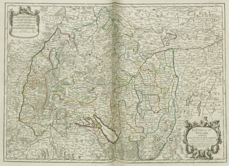
map of the upper rhenian circle by sanson
maps by nicolas sanson
perspective de la ville de paris, veue du pont des tuileries - silvestre incidit - btv1b53181589j
bibliothèque nationale de france
maps of béthune by braun & hogenberg
bibliothèque nationale de france
a topographical map of the county of berks (1761)
bibliothèque nationale de france
maps of vienne by braun & hogenberg
maps of lyon by braun & hogenberg
perspective de la ville de paris, veue du pont des tuileries - silvestre incidit - btv1b53181589j
bibliothèque nationale de france
bibliothèque nationale de france
prints by martin engelbrecht
bibliothèque nationale de france
braun/hogenberg dreizehn orte
maps of bourges by braun & hogenberg
maps of orléans by joris hoefnagel
maps of mons (hainaut) by braun & hogenberg
maps of arras by braun & hogenberg
maps of provence by pierre-jean de bompar
bibliothèque nationale de france
maps of béthune by braun & hogenberg
bibliothèque nationale de france
maps by willem and johannes blaeu
17th-century maps of xaintonge
bibliothèque nationale de france
braun/hogenberg dreizehn orte
a topographical map of the county of berks (1761)
bibliothèque nationale de france
a topographical map of the county of berks (1761)
bibliothèque nationale de france
maps of dordrecht by braun & hogenberg
bibliothèque nationale de france
maps of budapest by braun & hogenberg
maps of vienna by braun & hogenberg
eran laor cartographic collection
alexis-hubert jaillot
1800s maps of the iberian peninsula
maps of spain by tomas lopez
eran laor cartographic collection
pierre mortier
maps of the iberian peninsula by guillaume delisle
1700s maps of the iberian peninsula
honoré daumier
realism
pierre antoine tardieu
françois houiste
maps of the county of mark
guillaume sanson
philippe de la rué
périgord
maps of alsace by guillaume sanson
1660s maps of baden-württemberg
1760 maps of asia
baroque painting
maps by nicolas sanson
1730s maps of france
maps by jean-baptiste bourguignon d'anville
1750s maps of the caribbean
atlas géographique des quatre parties du monde (delisle)
18th-century double hemisphere world maps
unicycle
history
bibliothèque nationale de france
guillaume sanson
maps of the course of the rhine by guillaume sanson
bibliothèque nationale de france
map of l'evesché du mans by jaillot and cordier
bibliothèque nationale de france
maps of the course of the rhine by guillaume sanson
bibliothèque nationale de france
maps from gallica
guides joanne
map of l'evesché du mans by jaillot and cordier
bibliothèque nationale de france
bibliothèque nationale de france
guillaume sanson
bibliothèque nationale de france
guillaume sanson
bibliothèque nationale de france
félix robaut
maps of the course of the rhine by guillaume sanson
bibliothèque nationale de france
map of the circle of upper saxony by sanson
bibliothèque nationale de france
bibliothèque nationale de france
guillaume sanson
bibliothèque nationale de france
maps by jakob van der schley
1667 map of madagascar by guillaume sanson
bibliothèque nationale de france
map of the circle of swabia by sanson
bibliothèque nationale de france
bibliothèque nationale de france
guillaume sanson
map of modern syria by philippe de la rué
bibliothèque nationale de france
atlas géographique des quatre parties du monde (delisle)
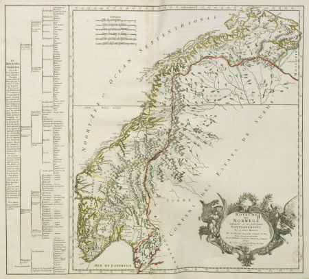
map of scandinavia by guillaume de l'isle (1706)
maps of the course of the rhine by guillaume sanson
maps by nicolas sanson
map of l'evesché du mans by jaillot and cordier
bibliothèque nationale de france
bibliothèque nationale de france
ambroise tardieu
carte des régences d'alger by hérisson
bibliothèque nationale de france
map of l'evesché du mans by jaillot and cordier
bibliothèque nationale de france
bibliothèque nationale de france
guillaume sanson
map of l'evesché du mans by jaillot and cordier
bibliothèque nationale de france
carte des pays-bas catholiques by guillaume de l'isle (1702)
atlas géographique des quatre parties du monde (delisle)
maps from gallica
guides joanne
bibliothèque nationale de france
guillaume sanson
petrocorii. evesché de périgord. partie septentrionale de la seneschaussée de perigord. partie septentrionale de l'eslection de périgord - par le sr sanson... - btv1b53227106v
guillaume sanson
atlas géographique des quatre parties du monde (delisle)
carte de france by guillaume delisle (1721)
bibliothèque nationale de france
guillaume sanson
maps from gallica
guides joanne
atlas géographique des quatre parties du monde (delisle)
carte de france by guillaume delisle (1721)
maps from gallica
guides joanne
maps of agnano and grotta del cane by braun & hogenberg
bibliothèque nationale de france
old maps of norway
guillaume sanson
bibliothèque nationale de france
guillaume sanson
map of l'evesché du mans by jaillot and cordier
bibliothèque nationale de france
bibliothèque nationale de france
félix robaut
atlas géographique des quatre parties du monde (delisle)
map of scandinavia by guillaume de l'isle (1706)
maps of île-de-france by françois de la guillotière
bibliothèque nationale de france
map of l'evesché du mans by jaillot and cordier
bibliothèque nationale de france
map of l'evesché du mans by jaillot and cordier
bibliothèque nationale de france
bibliothèque nationale de france
guillaume sanson
bibliothèque nationale de france
guillaume sanson
bibliothèque nationale de france
sanson maps of asia
atlas géographique des quatre parties du monde (delisle)
carte de france by guillaume delisle (1721)
bibliothèque nationale de france
guillaume sanson
maps from gallica
guides joanne
bibliothèque nationale de france
antoine dewasme-plétinckx
map of the circle of lower saxony by sanson
bibliothèque nationale de france
maps of île-de-france by françois de la guillotière
bibliothèque nationale de france
bibliothèque nationale de france
félix robaut
maps of bourges by braun & hogenberg
maps of orléans by joris hoefnagel
prints in the united states national library of medicine
polypharmacy
bibliothèque nationale de france
pierre haultin
17th-century maps of nord (department)
maps of artois
old maps of montenegro
old maps of dubrovnik
maps of burgos by braun & hogenberg
1645 in spain
pierre antoine tardieu
maps from gallica
2501 - 2600 of 3,429
Next page
/ 35


![Map of Finland / drawn up by P. Lapie, cap[itaine], ing[ieur], geog[raphe]; engraved by Tardieu aïné; written by Giraldon, 1808](https://cdn.creazilla.com/illustrations/10001359680/map-of-finland-drawn-up-by-p-lapie-capitaine-ingieur-geographe-engraved-by-tardieu-an-written-by-giraldon-1808-sm.webp)


![Map of the city of Douai / lith. by F[éli]x Robaut, Félix Robaut, 1846](https://cdn.creazilla.com/illustrations/10000982184/map-of-the-city-of-douai-lith-by-flix-robaut-flix-robaut-1846-md.jpg)


![L'Isle de France. Descrip[tio] of the field of Paris / François de La Hoeye made, 1619](https://cdn.creazilla.com/illustrations/10000573199/l-isle-de-france-descrip-tio-of-the-field-of-paris-fran-ois-de-la-hoeye-made-1619-md.jpg)


![L'Isle de France. Descrip[tio] of the field of Paris / François de La Hoeye made, 1619](https://cdn.creazilla.com/illustrations/10000432165/l-isle-de-france-descrip-tio-of-the-field-of-paris-fran-ois-de-la-hoeye-made-1619-md.jpg)


